METAR maps
Visualizing METAR weather data on a map
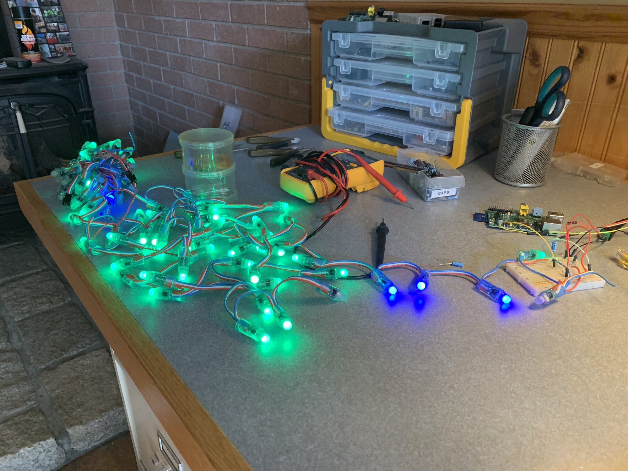
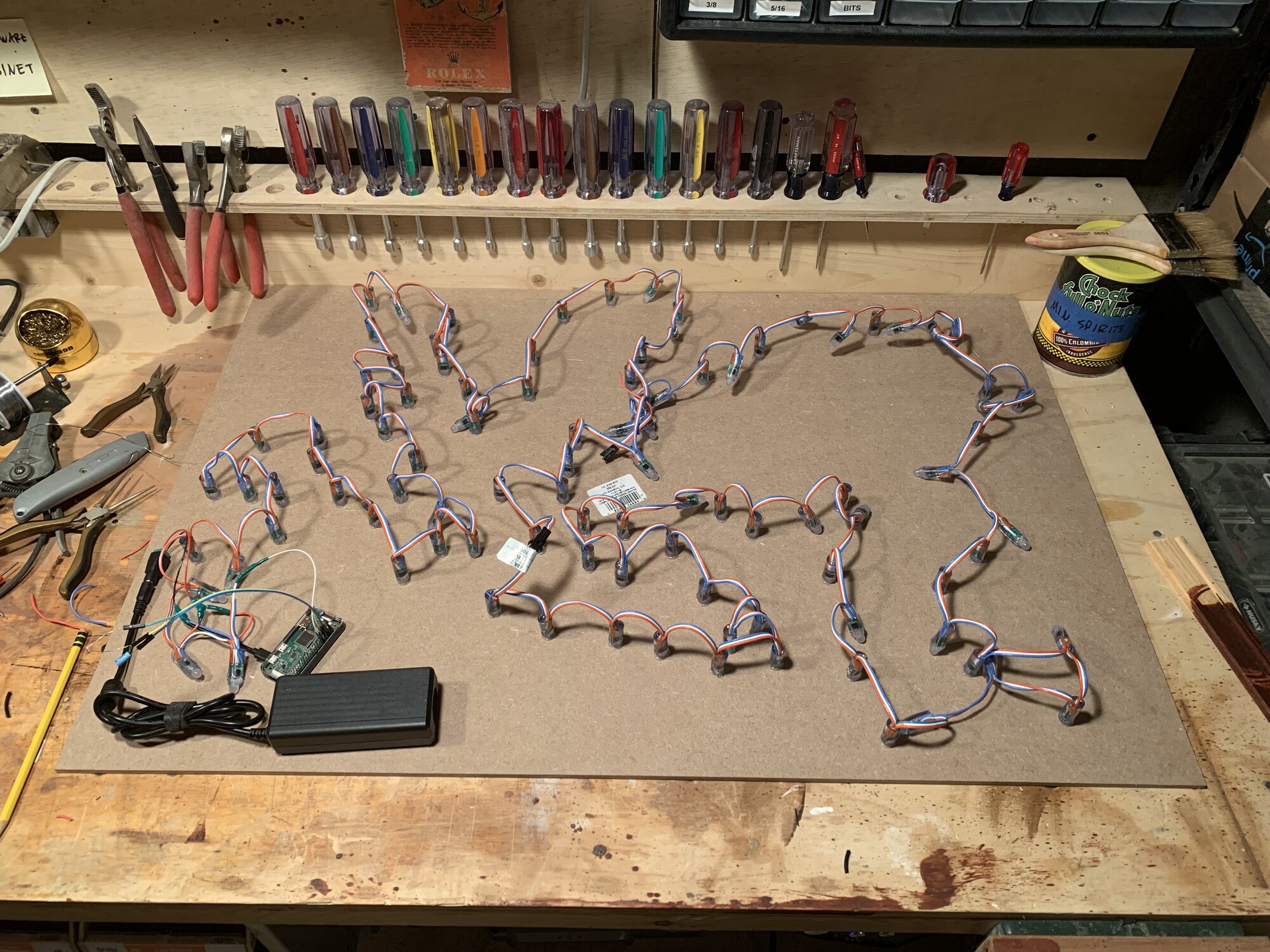
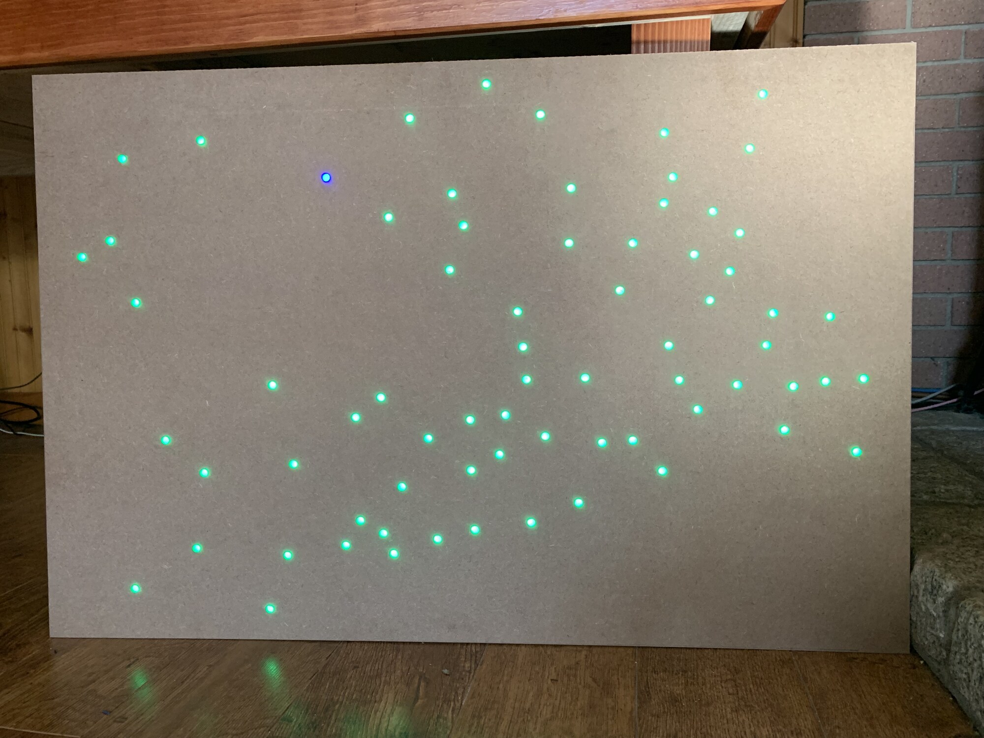
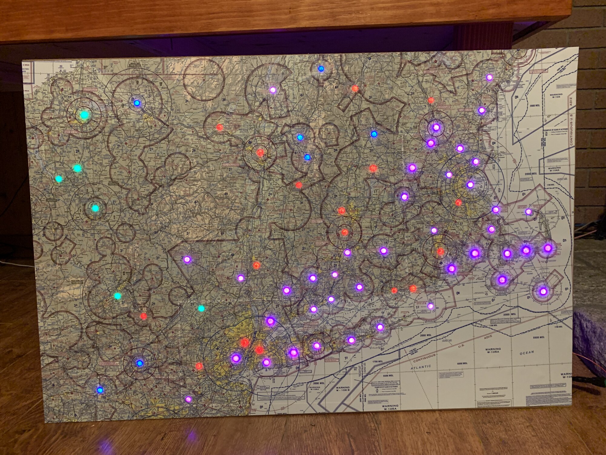
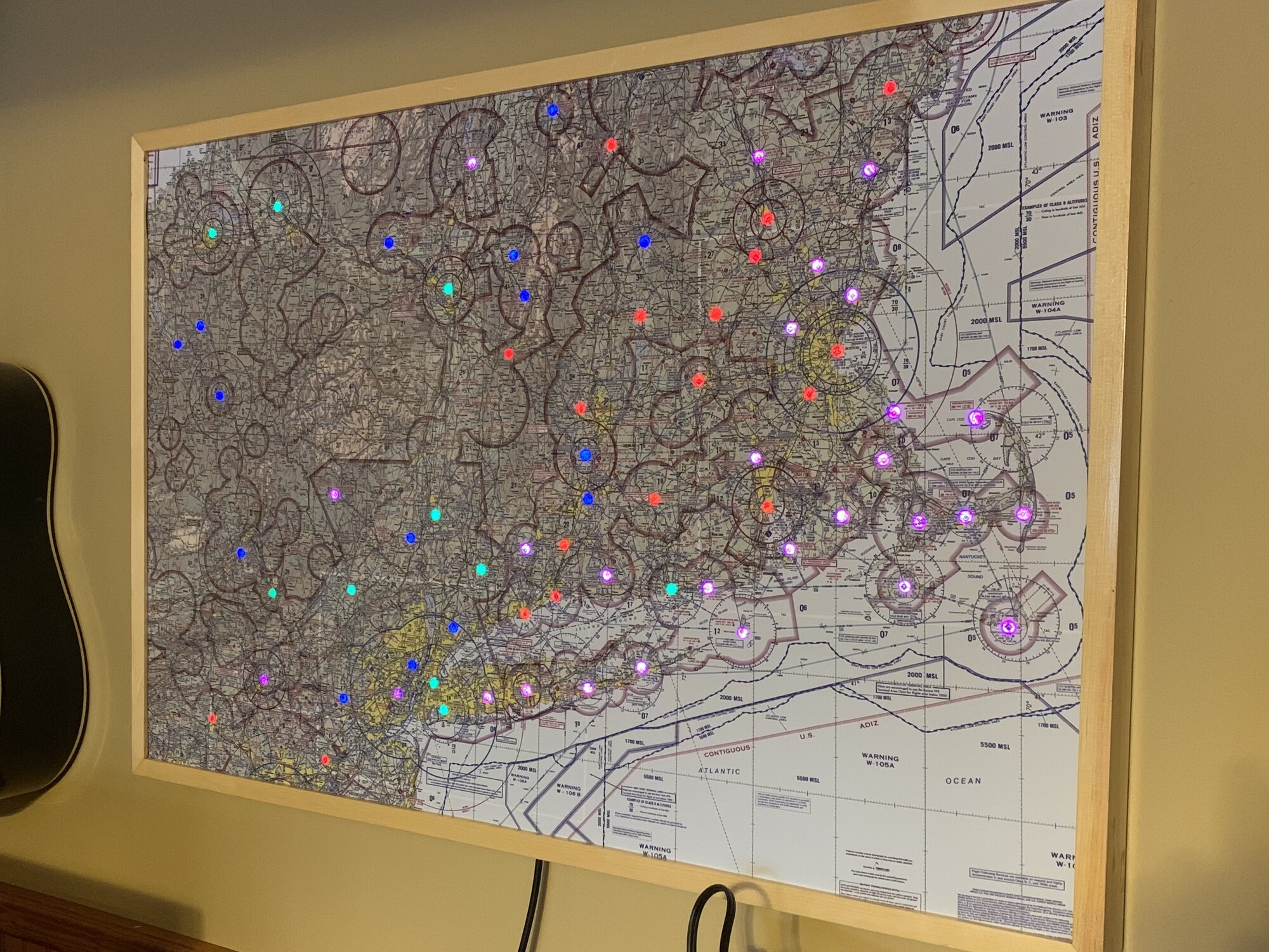
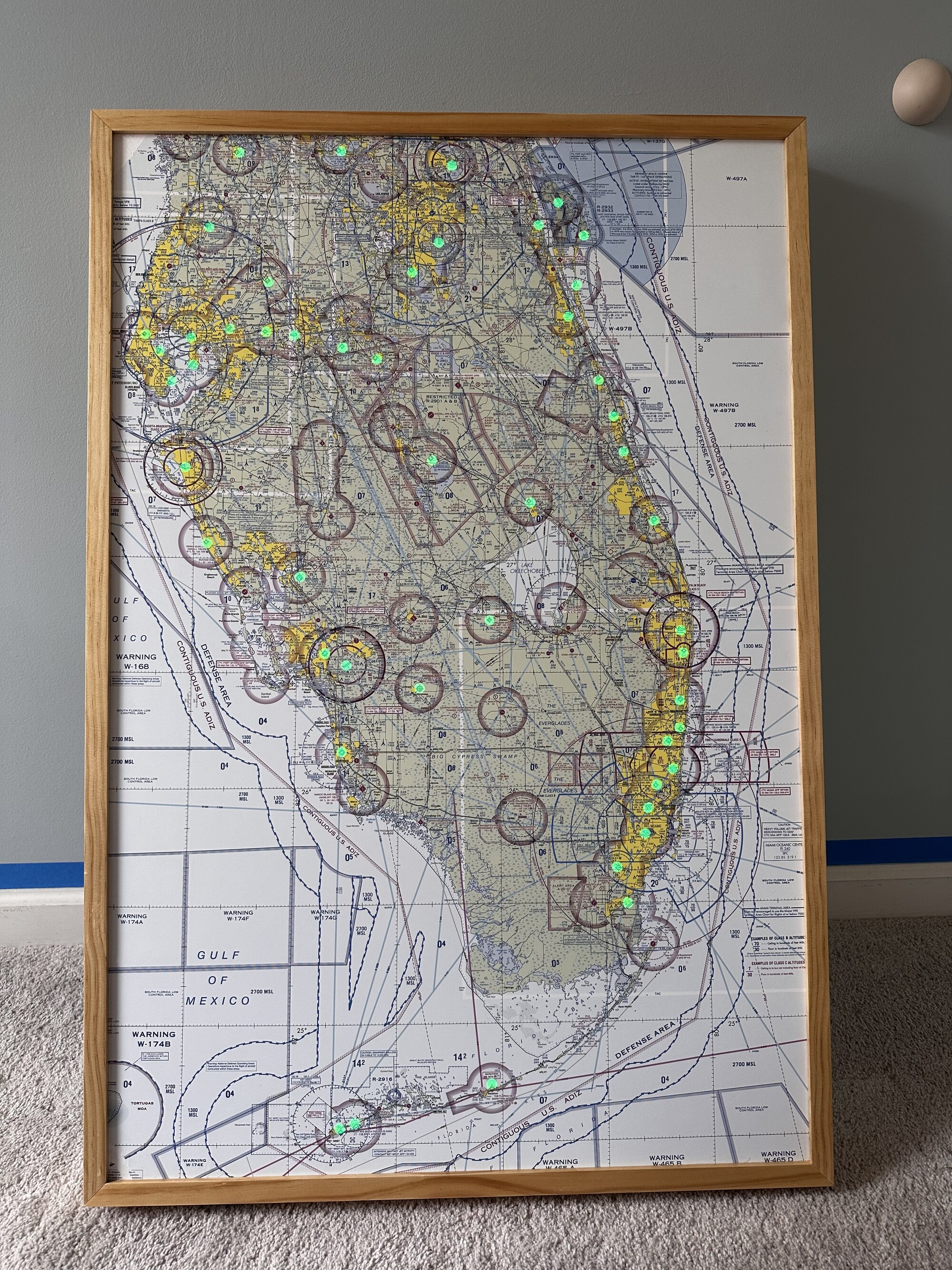
I have built two 24x36” maps that display airport weather conditions using individually-addressable LEDs. They are powered by Raspberry Pi Zero W’s running a custom Elixir Nerves application.
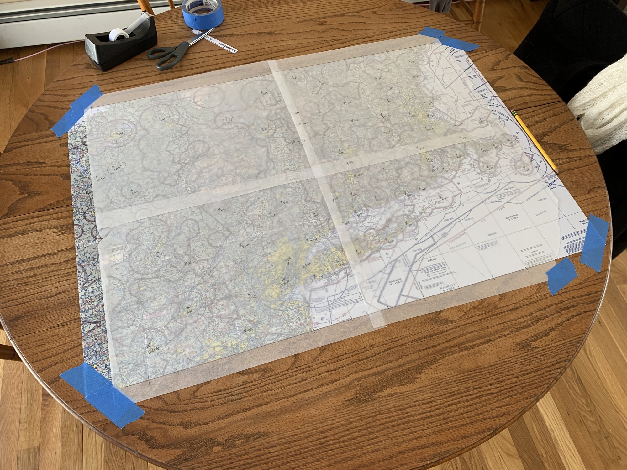
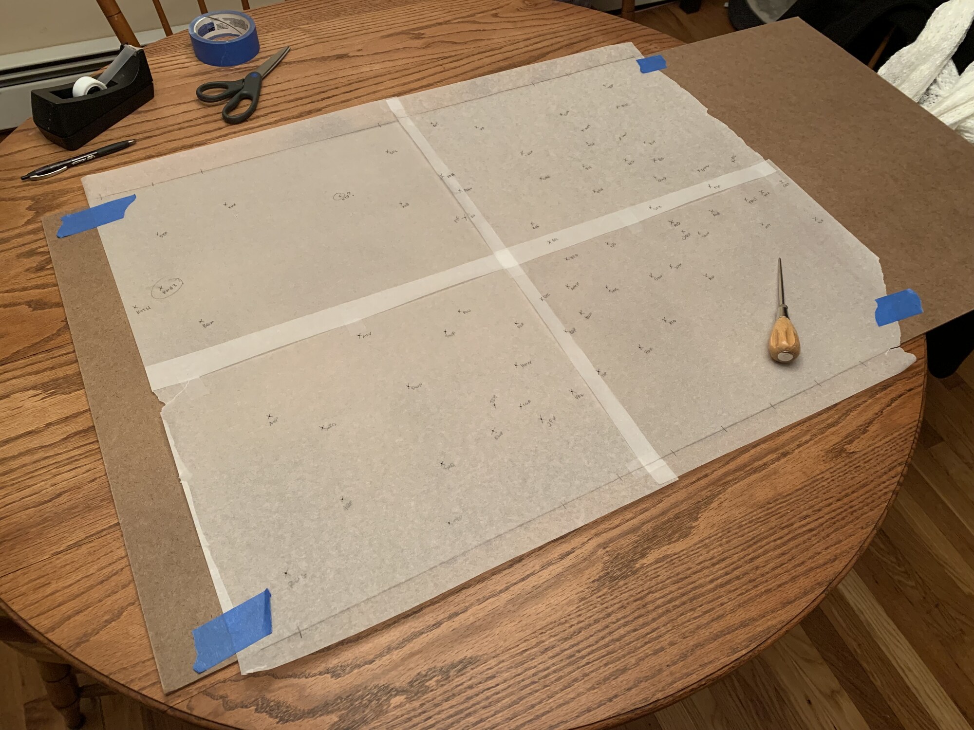
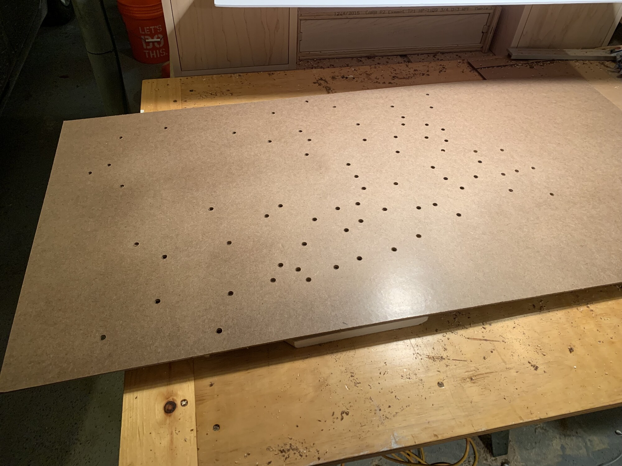
They are constructed from MDF with a printed map glued on top. LEDs shine through the map, making it magically come alive when powered on. They also have LDR sensors to automatically dim the LEDs when the room is dark. The frames are custom-made 1x3” stained pine.
| Conditions (best to worst) | Color |
|---|---|
| VFR (Visual Flight Rules) | Green |
| MVFR (Marginal VFR) | Blue |
| IFR (Instrument Flight Rules) | Red |
| LIFR (Low IFR) | Magenta |
Build process